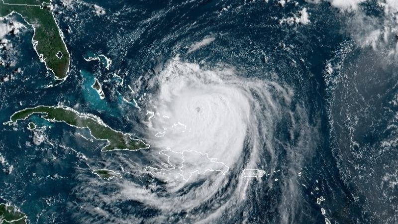
Hurricane Erin is a sprawling Category 4 storm churning in the Atlantic Monday after exploding in strength at a historic rate this weekend.
The storm’s enormous footprint is becoming the biggest concern as it brings heavy rain and gusty winds to islands far from its center and threatens to drive life-threatening rip currents and towering waves toward the eastern US coastline and Bermuda, all without making landfall.
Erin’s outer rain bands lashed Puerto Rico over the weekend, triggering flash flooding and power outages, and started impacting the southeast Bahamas and the Turks and Caicos Islands early Monday. Rough seas and large swells from the hurricane will reach much of the US East Coast and Bermuda starting Tuesday, with conditions expected to worsen through midweek.
“Even though Erin is expected to remain far offshore, the threat to life from rip currents and high surf along our beaches is very real,” the National Weather Service office in Morehead City, North Carolina warned.
Erin is forecast to curve north-northeast between the US East Coast and Bermuda over the coming days, remaining out over the water but growing even larger in size. That means its influence will be felt not through direct landfall, but through water: large, pounding surf, dangerous currents and coastal flooding during high tides.
Continue reading the complete article on the original source


