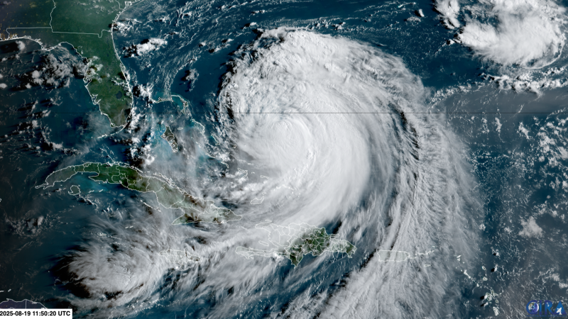
Hurricane Erin is churning up life-threatening rip currents and dangerous surf along much of the US East Coast and will soon send destructive waves and storm surge to North Carolina’s Outer Banks. Meanwhile, Atlantic hurricane season is hitting its stride, threatening to spin up another named storm in Erin’s wake.
Erin, a sprawling high-end Category 2 hurricane with sustained winds just shy of Category 3 status, is not forecast to make landfall but will impact much of the East Coast with dangerous coastal conditions as it tracks north, nearly paralleling the coast. Bermuda will face similar conditions to the storm’s east.
The impact is already being felt on US coastlines. At least 75 rip-current rescues were conducted along North Carolina’s southern coast Monday, officials in New Hanover County reported. The county’s Wrightsville Beach has issued a no-swim advisory through Friday.
A tropical storm watch stretches from the middle of North Carolina’s coast north past Kitty Hawk, including the Pamlico Sound. The watch means tropical-storm-force winds (39 to 73 mph) are possible within 48 hours.
Dare and Hyde counties, which encompass most of the Outer Banks, have already issued local states of emergency with mandatory evacuations for Hatteras and Ocracoke islands.
Continue reading the complete article on the original source


