Hurricane Humberto rapidly intensified into a Category 5 storm Friday and Saturday over the warm, energy-filled water of the open Atlantic Ocean. But there’s quiet threat creeping toward the Southeast coast that people there should keep their eye on.
A strengthening tropical depression brewing near the Bahamas could bring flooding rain, coastal storm surge, damaging winds and dangerous surf to the Southeast as early as Monday, leaving very little time for people to prepare.
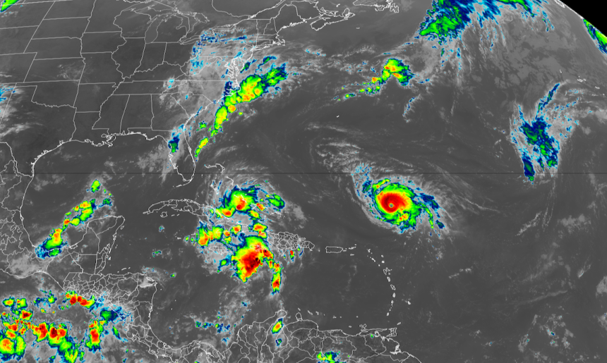
Tropical Depression Nine formed Saturday morning between Cuba and the Bahamas with maximum sustained winds of 35 mph, according to the National Hurricane Center. The storm is forecast to become Tropical Storm Imelda tonight or early Sunday, and a Category 1 hurricane by late Monday or Tuesday.
Tropical storm warnings are in effect for the Bahamas this weekend, and tropical storm watches are now up for the east coast of Florida from the Palm Beach and Martin County line northward to the Flagler and Volusia County line. Tropical storm-force winds are possible in those parts of the state on Monday, though the system is expected to remain offshore as it moves north.
Forecast models take the storm’s center across the Bahamas this weekend before steering it toward the Southeast coast by early next week. The hurricane center continues to predict it will then slow down as it approaches the South Carolina coast, turning to the east before it has a chance to make landfall.
Continue reading the complete article on the original source